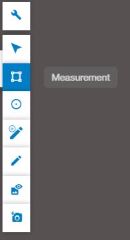
The 3D view includes a hidden toolbar in the top-left corner, offering various tools to work with project data.
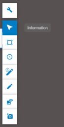
The Information tool is selected by default. Its purpose is to allow you to select a data element and view details about it. The element can be a point cloud, vector feature, or panorama.
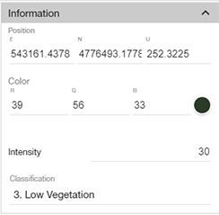
Details about the selected element appear in the Properties section, located in the right panel.
When a point from a point cloud is selected, information about its position, color, and classification is displayed.
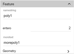
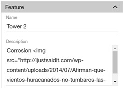
If a vector feature is selected, its attributes will also be displayed in the Properties section:
Additionally, if the vector feature contains a name and description, these will appear in a popup window next to the feature.
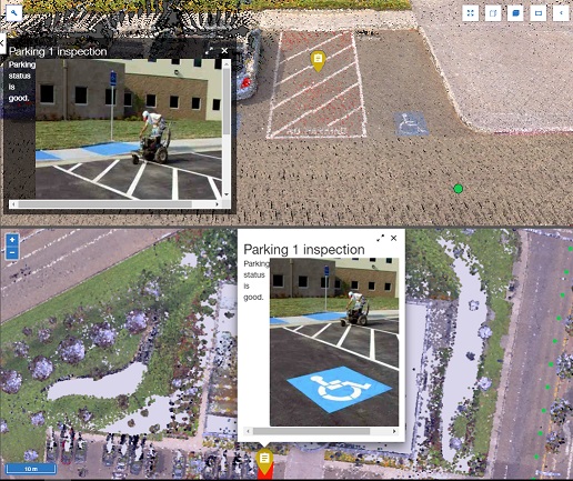
Note: The description can be formatted using HTML, allowing images, links, and iframes to be embedded in the popup.
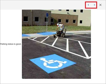
The popup contains buttons to expand and close the description view.

When expanded, the description view includes buttons to navigate between features, making it easier to view multiple descriptions.
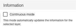
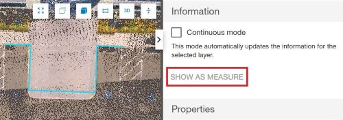
The Information tool has a “Continuous Mode” that automatically updates the information as the cursor moves, provided only one layer is selected.
The Measurement tool is located in the 3D View toolbar:
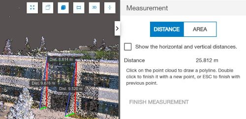
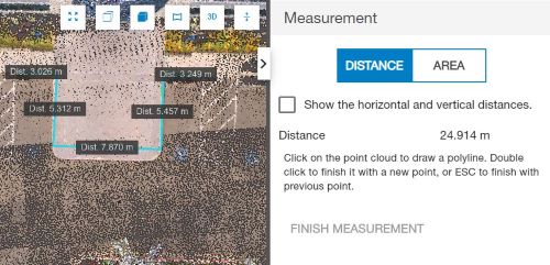
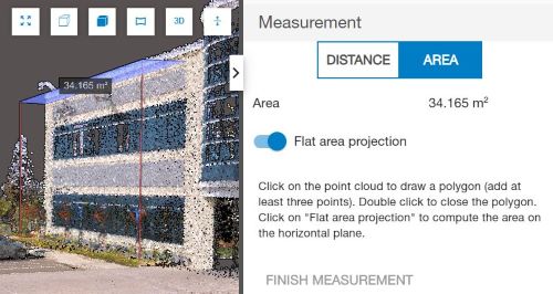
This tool includes modes for Distance, Area, and Elevation measurements. To measure, simply click on points in the point cloud to define a line or polygon. To finish, double-click to confirm the last point or use the "Finish Measurement" button, or press ESC.
General tips for using Collage Web’s measurement tools:
In Distance Mode, the tool reports the length of each segment in the 3D view and the total distance in the Measurement tool panel.
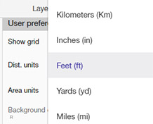
You can change the units used for distance measurements in the Preferences menu.
To create a measurement based on an existing line feature, select it with the Information tool, then click the "Show as Measure" button.
In Area Mode, the tool calculates the total area in the 3D view and in the Measurement Tool panel. The area units can also be adjusted in Preferences.
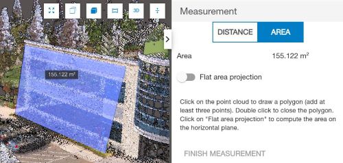
There is an option to perform 2D area measurements by considering the area as flat.
Similarly, you can select a polygon feature in the 3D view, then use the "Show as Measure" button to calculate its area.
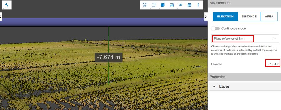
In Elevation Mode, you need to have at least a design data layer to create a reference plane in the scan project, the tool measures the height difference between the selected point in the point cloud and a chosen reference plane, or it can directly retrieve the altitude of the point within the project.