Note: This beta function is provided with no charge and no warranty for quick preview of new features before official release. Please note that it may have less reliability relative to an official release version.
The 3D view has a hidden toolbar in the top left corner containing different tools to work on the site data.
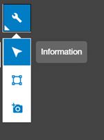
This tool is selected by default. Its purpose is to select a data element and offer information about it. The selected element can be a point cloud or a vector feature.
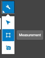
The Measurement tool is located in the 3D View toolbar:
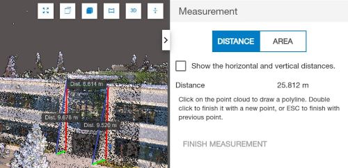
This tool includes modes for Distance, Area, and Elevation measurements. To measure, simply click on points in the point cloud to define a line or polygon. To finish, double-click to confirm the last point or use the "Finish Measurement" button, or press ESC.
General tips for using Collage Web’s measurement tools:
In Distance Mode, the tool reports the length of each segment in the 3D view and the total distance in the Measurement tool panel.
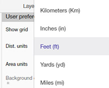
You can change the units used for distance measurements in the Preferences menu.
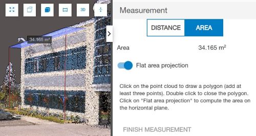
In Area Mode, the tool calculates the total area in the 3D view and in the Measurement Tool panel. The area units can also be adjusted in Preferences.
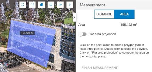
There is an option to perform 2D area measurements by considering the area as flat.
Similarly, you can select a polygon feature in the 3D view, then use the "Show as Measure" button to calculate its area.
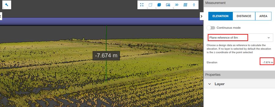
In Elevation Mode, the tool measures the height difference between the selected point in the point cloud and a chosen reference plane, or it can directly retrieve the altitude of the point within the project.